



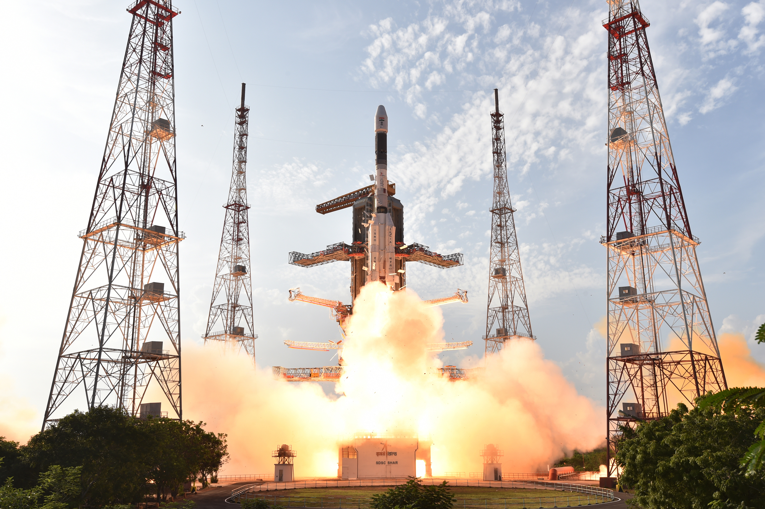
India has successfully launched EOS-05 aboard GSLV-F17, placing the country’s first imaging satellite designed for geosynchronous orbit into its intended transfer orbit. The mission lifted off from the Second Launch Pad at the Satish Dhawan Space Centre in Sriharikota at 2:55 am IST on September 4, 2026.
The Indian Space Research Organisation confirmed that the rocket completed its flight successfully and injected EOS-05 into a sub-geosynchronous transfer orbit. The spacecraft will now use onboard propulsion and a sequence of carefully planned manoeuvres to reach its operational position.
The launch is important not simply because another satellite reached space, but because EOS-05 is intended to give India a persistent view of a large part of the Earth from roughly 36,000 kilometres above the planet. Unlike many low-Earth-orbit imaging satellites that pass over the same location only at intervals, a geosynchronous platform can observe the same broad region repeatedly and at high frequency.
What is EOS-05?
EOS-05 is a state-of-the-art Earth-observation spacecraft weighing more than 2,360 kilograms and designed for a mission life of approximately ten years. ISRO describes it as India’s first imaging satellite from geosynchronous orbit.
That orbit is the key to the mission’s value. A satellite positioned far above the equator can keep pace with Earth’s rotation, allowing instruments to revisit the same region much more frequently than conventional polar-orbiting observation satellites. This can provide near-continuous situational awareness during rapidly changing events.
Potential applications include monitoring cyclones and severe weather systems, mapping floods and forest fires, tracking agricultural conditions, observing coastlines and supporting disaster-response agencies. The full practical value will depend on the spacecraft’s final orbital position, sensor performance and the data products released after commissioning.
Why the GSLV-F17 mission matters
GSLV-F17 was the 19th flight of India’s Geosynchronous Satellite Launch Vehicle. The three-stage rocket uses four liquid strap-on boosters and an indigenously developed cryogenic upper stage—a technically demanding system that burns liquid hydrogen and liquid oxygen.
The successful flight is especially significant after recent setbacks in India’s launch programme. It demonstrates that the GSLV line remains capable of carrying heavy spacecraft toward high-energy orbits and restores momentum for upcoming missions.
Prime Minister Narendra Modi called the achievement a proud moment for the country and said it reflected India’s growing capabilities in space technology. The mission also highlights the combined contribution of ISRO centres, Indian industry, academic partners and the supply chain that supports the national space programme.
How geosynchronous imaging differs
Most detailed Earth-imaging satellites operate much closer to the planet. Their lower altitude can deliver fine spatial detail, but each spacecraft sees only a comparatively narrow strip of Earth during an orbital pass. Operators therefore use constellations or wait for another pass to revisit an area.
A geosynchronous imaging satellite trades some of that proximity for coverage and timing. From high altitude, EOS-05 can watch a vast footprint and revisit selected regions quickly. This makes it particularly useful when conditions change by the minute—during cloud formation, a cyclone’s intensification, a spreading wildfire or a large flood.
The satellite is not a replacement for India’s existing observation fleet. Instead, it should complement lower-orbit systems by providing a broader, more continuous layer of information. Data from multiple spacecraft can then be combined with ground observations for a more complete assessment.
What happens after launch?
Reaching transfer orbit is only the first major milestone. Mission controllers must establish stable communication, deploy the spacecraft’s solar arrays, conduct orbit-raising manoeuvres and test its platform and imaging payload. The satellite will be declared operational only after these commissioning steps are completed and performance has been validated.
Readers should therefore distinguish between the confirmed success of the launch and claims about operational capability that can be assessed only after commissioning. ISRO has confirmed injection into the intended orbit; the quality, cadence and availability of imagery will become clearer as the agency activates the spacecraft.
Why this matters for India
India faces recurring cyclones, floods, drought, forest fires and agricultural stress. Faster observation can help authorities understand how an emergency is evolving, identify affected areas and prioritise resources. Frequent imagery may also improve weather analysis, crop monitoring, water management and environmental planning.
For the domestic space sector, the mission creates opportunities in downstream services such as geospatial analytics, insurance assessment, logistics, agriculture technology and emergency management. The economic impact will depend on timely access to usable data and the ability of public agencies and private companies to turn imagery into decisions.
EOS-05 is consequently both a technological milestone and a test of how effectively India can convert space infrastructure into public value. Follow HMP’s India coverage and technology updates for further developments after the satellite reaches its operational orbit.
Verification note: HMP cross-checked the launch time, vehicle, payload and orbital-injection status against ISRO’s mission announcement and Government of India reporting. Operational performance remains subject to on-orbit commissioning.